Discovering Our Past: College of Charleston Histories Logo
Stories Tours Map
Search Menu
Advanced Story Search ▸
Sitewide Search ▸
  • Home
  • Stories
  • Tours
  • Map
  • About
View a Random Story
App Store Google Play

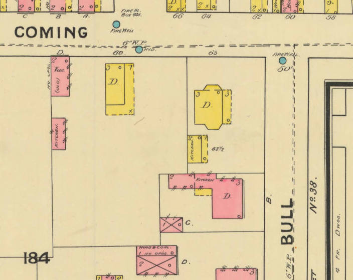
Fire insurance map of the area

ID: 480 | This file appears in: 63 ½ Coming Street/Solar Pavilion
Fire insurance map of the area
This 1888 Sanborn Fire Insurance Map shows the structures that once stood at the intersection of Coming and Bull Street. The letter "D" designates a private dwelling. Courtesy of the University of South Carolina South Caroliniana Library.
Download Original File
"Fire insurance map of the area" appears in: 63 ½ Coming Street/Solar Pavilion
Advanced Story Search ▸
Sitewide Search ▸
App Store Google Play
  • Home
  • Stories
  • Tours
  • Map
  • About
View a Random Story
© 2026 College of Charleston
Powered by Omeka + Curatescape